Do earthquake hazard maps really predict future building damage?

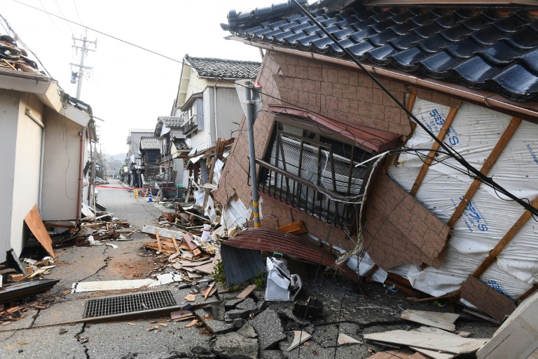
The magnitude-7.5 earthquake and its aftershocks devastated parts of Ishikawa prefecture on the Sea of Japan coast – Copyright AFP Toshifumi KITAMURA
The best way to reduce deaths in future earthquakes in vulnerable areas is generally presented as constructing buildings that can withstand them. However, because earthquake-resistant construction is expensive, communities need to balance its costs with other societal needs.
Therefore, tough choices are required and decisions about how to allocate resources are often based on earthquake hazard maps to predict how much shaking to expect over the many years buildings and other structures will be in use.
How accurate are these maps? Such maps are based on assumptions about where and how often earthquakes in the area may happen, how big they will be and how much shaking they will cause.
There is an apparent discrepancy between maps of earthquakes and the actually recorded shaking data. This is according to a new study by Northwestern University, as Phys.org reports. This presents a puzzling problem with maps of future earthquake shaking used to design earthquake-resistant buildings.
Seismologists have been making such maps for over fifty years. Yet they know remarkably little about how well they actually forecast shaking. This is because large damaging earthquakes are infrequent in any area.
To help to address this knowledge gap, Northwestern researchers compiled shaking data from past earthquakes. These included the CHIMP (California Historical Intensity Mapping Project) which combined data from seismometers with historical data (termed seismic intensity) that measures ground shaking caused by earthquakes from how it affected man-made structures and objects within the quake area.
Intensity information can be assessed from photographs of damage, first-hand or newspaper accounts, and oral history.
This assessment revealed that hazard maps for the U.S. (California), Japan, Italy, Nepal and France seemed to overpredict the historically observed earthquake shaking intensities.
In analysing the possible causes, the researchers discovered the issue was with the conversion equations used in comparing hazard maps predicting future earthquakes with actual shaking data, rather than systemic problems with the hazard modelling itself.
The researchers found that the problem was not with the maps but with the conversion. This will provides the basis for making improvements.
The research appears in the journal Science Advances. The research is titled “Why do seismic hazard maps worldwide appear to overpredict historical intensity observations?”
Do earthquake hazard maps really predict future building damage?
#earthquake #hazard #maps #predict #future #building #damage


